
A Closer Look at the North McDonough Road Project – Begins in June 2015
Decatur Metro | March 17, 2014 | 9:36 am
Included in a report from Decaturish late last week – about the North McDonough Streetscape Improvements and how it relates to renovating Decatur High Schoo – was this nugget…
The streetscape project will begin in June of 2015 and will last for 12 months. The city will shrink the road from four lanes to two in order to make it friendlier for bicyclists and pedestrians.
Upon request, Deputy City Manager Hugh Saxon provided DM with a digital version (PDF) of the most recent streetscape plan so that everyone can get a closer look what North McDonough will eventually look like once the project is completed.
Click the PDF link above or the photo to view the plans up close.


This is the visual with the cross-sectional view that has giant people, taller than SUVs in it. And I’m looking forward to the flowers. They look really pretty. Kind of a Southern California look.
One of the cars in the cross-section is a VW Touareg, whose height is listed at 68.2″. Doesn’t take a giant to tower over that. A Chevy Suburban – not a small car by any means – is 74″ tall. That is a bit over 6′. The drawing seems to be in proportion to me.
Now how about narrowing Decatur International Speedway (aka Commerce Drive)?
The 4-way stop and narrowed area behind the high school have created traffic nightmares and discourage use of what used to be a great way to go around downtown rather than through downtown.
That was the point of the diet. A thoroughfare should not go through that neighborhood and school area.
thank you.
So a question to you and others who go through (or used to go through) that area: are you now going through downtown to avoid that section of Commerce? If so, what route?
And that’s great! Can’t wait until they do the same on the north side so that I can cross Commerce from Clairemont or Church without hoping and praying that the speeding idiots obey the traffic lights!
Think they should do a tunnel where N. McDonough meets Howard, for under the tracks. reduces traffic jams, train horns, and better for bikers…
Got several $million?
I think “several” may be generous. I’m thinking quite a bit north of that.
Yeah, the estimate to do that at Candler was on the order of $10M as I recall.
Just use Commerce at College. Already bridged for our convenience.
Can we get a left-turn signal there if that is the preferred way to cross the tracks?
The left lane on Commerce southbound to College eastbound is a through-lane with a left turn signal. There is no left turn signal going from College to Commerce, however, and that is annoying.
I really like the cycle track. We need an uninterrupted network of cycle tracks and bike lanes throughout all of Decatur.
Removing the left turn lane as shown could create huge backups at rush hour as southbound McDonough drivers get stuck behind those trying to turn left on College. Traffic is already nightmarish and dangerous at this intersection in the mornings. I’ve sat at that light for 4 cycles, trying to go straight across the tracks, even though there IS a left turn lane now.
I’m all in favor of safer biking, especially around the schools, but I’ve literally NEVER seen anybody on a bike in a Decatur bike lane. Meanwhile the car traffic clogs the roads where turn lanes are shortened or removed when lanes get removed (in front of Glenlake Park, corner of Commerce and Trinity, for example). With the massive numbers of apartments and condos coming to Decatur, how will the narrow roads handle all those extra cars? Even though Decatur is very walkable, most of those apartment dwellers will be driving.
Good point. However, it looks to me like there will be enough room straight-going traffic to go around left turners in that intersection, especially since there are four lanes on McDonough past that intersection. If that doesn’t work, then it will not be a huge fix to narrow the lanes at that intersection and make a left turn lane, especially where that yellow triangle is.
I think they should retain the left turn too, but it will be a quick fix if they don’t and it doesn’t work out.
I don’t believe the people who come up with these ideas ever drive through Decatur at rush hour. McDonough already backs up significantly traveling south in evening rush hour with a designated left turn lane. This will make matters significantly worse. But you’ll be able to ride your bike for one whole block on a designated path so it is all worth it.
I like the road diet, and have seen lots of folks in the decatur bike lanes including myself on occasion. It makes no sense for that stretch to be four lanes, but:
Where will the school buses let students off in the morning or pick up in afternoon? Parking places are shown where the buses usually drop off/pick up. Please don’t tell me they are going to be routed to the upper lot or the commerce entry lot.
I also agree that a 6 or 10 car length left turn lane is needed for getting across the railroad tracks.
And one last comment, the marta buses will run over those pretty flowers on the corner of Trinity and Mcdonough across from chick fil a. That’s way too tight.
If you look at the arrows painted on the lanes there is a straight ahead arrow but no left turn arrow at Howard/College. So I don’t think left turns will be allowed onto College.
I seem to remember some talk of this in a traffic study a couple of years ago. I think people going East on College will have to go to Commerce to the East or Thinking Man Tavern, (whatever that crossing is called), to the West to turn East on College.
Yes, I agree. It seems quite unlikely that a bike lane in front of a high school will see much use.
I agree that various peak time traffic will have to be addressed, but I’m confident they can be handled through intersection lane configuration and signalization. What’s more important to point out, IMO, is that infrastructure should rarely if ever be built to serve present conditions. It should be planned to serve future conditions — both those you want to create and those anticipated in the data. Ideally both, because that means you have a reality-based vision.
Decatur has a long-term transportation vision predicated on multi-use street where space is shared more equitably among all types of users, so that’s the first part. The second is that Vehicle Miles Travelled has peaked in the US and has been on the decline for several years now (this data holds up, even when corrected for the effects of the Recession). In changing the configuration of our streets, we’ll see one of three things: some people will find the hassle unacceptable and will choose another route; some will choose another mode of travel around town; and some will accept the change and continue with business as usual. All are fine choices. What’s important is that we’re leveraging a careful study of emerging market preferences and implementing them in a way that supports a long-term vision.
No argument that any changes will take getting used to. But traffic will never become insurmountable. It will always be self-correcting through user choices.
We’ve been inducing demand by widening every damn road in the metro area for 50+ years. Reclaiming some of that public space to shift demand somewhere else isn’t a bad idea.
If you’re trying to drive SR155 through the center of downtown, you may want to find another route or adjust your expectations for travel time. I say this as someone who drives that route daily and has a significant commute, but who wants my downtown to be a neighborhood and not a thoroughfare.
+1
I nominate Scott for President of Decatur Traffic Solutions, Logical/Rational/Long-view category. Rival for VP.
If Scott adds any more hats on here, he’ll need to change his name to Bartholomew Cubbins.
Sr155 goes around downtown on comerce
True. I guess I was thinking more of the Candler-Trinity-Commerce route that lots of drivers take. I’d argue that the 155/Commerce route is not “around” downtown anymore. If development trends continue, all those routes could be through a congested area of businesses and soon-to-be residential mixed-use buildings.
So maybe we should investigate the idea of an Outer Perimeter for Decatur. As the county seat, most roads lead to Decatur, which means a lot of people go through Decatur, especially if they have to cross the railroad track. As Emory and CDC continue to grow I think this will continue. I have to deal with Church Street and don’t cross the tracks during rush hour but keep those who do in my prayers.
I disagree. I think roads should be designed for multiple transportation options and not multi-lane bypasses for cars. Building a bypass won’t help. Transportation infrastructure brings development and congestion. The same thing will happen.
Go look at old photos of 285 exits. There was nothing around that far out at construction. Seemed like a good place to route truck traffic, right? Well, 285 brought lots of people by land that was owned by someone. And that land got developed. Anybody seriously think 285 is a bypass anymore?
Rival . . . for the win . . . AGAIN.
It’s time to let everyone know that transportation planning has moved on past 20th century auto-centric solutions. Or at least it’s headed in that direction. The goal of moving cars quickly from point A to point B proved to spin off so many negative externalities that we are lucky to have survived at all (hyperbole, but only by a bit). If it was thought to be a good idea 40 years ago at the state DOT – it probably wasn’t, and we feel the effects of those bad decisions over and over. Thankfully, we as a community, decided to move in a different direction, one that allows priority for human-powered transport. These transportation projects we are seeing move forward locally are an outgrowth of 21st century planning – the sort of planning that might slow you down if you are in a car, but will help contribute to a healthier community – physically, emotionally, and economically.
I think I might like to go the route Portland and some other places have taken: separate bike paths for bicycles, four lane roads for automobile traffic, and a mix on smaller roads. As stated, I-285 is fast losing its status as a bypass, partially because it loops Atlanta so closely, unlike, for instance I-275 around Cincinnati. In any event, pedestrian and bicycle traffic isn’t allowed on this interstate, and for good reason. Different roads can have different purposes.
Rush hour traffic through Decatur is heavy and will remain heavy. As noted, Commerce isn’t as much a bypass as it once was, but it does keep traffic off Ponce. I don’t think the best option is to strangle automobile traffic on the main roads. A consequence of this may be that people start cutting through the neighborhoods on roads that aren’t designed for high volume automobile traffic. Instead I would prefer to build separate bike paths and bike lanes on streets designed for roads already built for low volume automobile traffic and keep high volume automobile traffic on streets designed for that volume.
I also believe as the county seat Decatur has responsibilities for those driving in and out of Decatur each morning. The courthouse staffers who live in Stone Mountain, Chamblee, south DeKalb and elsewhere must drive to work. Various other county residents, including jurors, also come and go each day via car. I’m a Decatur resident whose job moved away from the Clifton corridor so I must traverse Decatur by car each day.
Making Decatur’s roads chokepoints in an effort to discourage people from driving may reduce some traffic, but as long as the courthouse and county administration buildings sit on and around the square, and as long as the metro Atlanta transportation options remain limited, I don’t see much reduction in our future. I simply see drivers finding alternate ways in, out, and through Decatur on residential streets to avoid the bottlenecks. I don’t think COD residents would prefer this outcome. I’m not against cycling and walking. As a resident, I do plenty of both (although much less when it’s snowing, raining heavily, below 40 or above 85 degrees). I’d simply like to find the best ways to walk, cycle, and drive and am not convinced every road is appropriate for all current transportation options. If so, maybe I’ll buy a horse and buggy and see how that goes.
I wish there was a long term comprehensive plan to completely reimagine the entire downtown traffic plan. These projects pop up individually.
For example, I can imagine a revised traffic flow heavily dependent on one way streets – and street scapes like this post. It could be possible to design such a flow to accommodate traffic around as well as through downtown. The 2010 called for a study of traffic lights, but nothing this comprehensive.
There is a long-term plan in the CTP. I don’t know how it specifically aligns with what you mention here though.
Nearly every morning I am riding either the bike lane down (west) Commerce or the bike lane down West Ponce. And I see other bike commuters all the time (daily on the lane on Ponce, less often on Commerce).
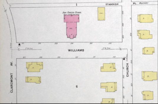
One of the non-obvious problems with the N. McDonough/College intersection is that multiple points of relief have been eliminated by one-way streets. On that diagram there are Maple and Howard, both running one-way, east-west. Outside of the diagram you have E. Dougherty street, which has also been made into one-way, east-west over the past several years. There is also nearby N. Candler, one-way south-north.
Each one of these are likely defensible individually, but add them all up and they start to cause problems that this new streetscape is intending to solve. I’m not against the streetscape plan from a pedestrian and aesthetic perspective, but the additional restrictions on vehicular traffic this imposes this is only going to increase the road sewer effect on College, Candler, and elsewhere.
Just to underline what I’m saying – if this project eliminates left turns from N. McDonough onto eastbound College, then there would be a stretch from Chik-fil-a to Davis Street, 4 intersections in a row, where left turns are not allowed. This is classic sprawl thinking – rather than build an interconnected grid that provides multiple options and spreads traffic across many streets, this perpetuates the feeder-collector mentality that fundamentally ails us.
The Snowjam led to an insightful piece that articulates the situation and alternatives well, I think:
http://www.chicagomag.com/city-life/January-2014/How-the-Urban-Grid-Prevents-Atlantas-Heart-Attack-Traffic/
This is very pretty, but it is a huge investment with limited payback. Best case scenario is the streetscape improvements might encourage redevelopment on the east half of the street. I’d much prefer improvements to Church from Ponce north. The commercial redevelopment potential is much greater.
I believe both this project and the project you reference are active efforts in queue (or in queue to be in queue, so to speak) for Federal funding. One is not at the expense of the other. It’s just been in the pipeline longer.
In past threads, several bicyclists have stated that they don’t use the path along the RR tracks because there are too many strollers and people in the way. I’d be interested to know if they would use the cycle track in this plan, or would use the roadway instead.
Also, does anyone know the status of the intersection improvements along the RR tracks at Candler and McDonough? I recall attending a meeting 4-5 years ago hosted by the DOT.
Here:
http://www.dot.ga.gov/projects/transpi/Pages/TransPi.aspx?ProjectID=0009025
and here:
http://www.dot.ga.gov/projects/transpi/Pages/TransPi.aspx?ProjectID=0002669
May be moderated because of links…
I dislike that particular path – largely due to the pedestrians, kids walking to school, police officers parking their car on the path, cars blocking the place to cross at Atlanta Ave., etc. I will bike Howard/Dekalb Ave except during peak rush hour (8ish).
The whole Stone Mountain path was designed before what I would call modern bike path standards. As a commuter I’d rather see a wider road and bike lanes, but as a parent it serves families well. Its current implementation doesn’t accommodate well these cross purposes
I like this plan overall, but haven’t seen details on how people will access the cycle track. This kind of protected bikeway is very safe and attractive if you get the intersection treatments right. Was anyone at the meeting able to find out more?
Nice to see the Community Transportation Plan being implemented:http://www.decaturga.com/Modules/ShowDocument.aspx?documentid=1221. I just wish there were real transportation funding in the region so we didn’t have to go through the ridiculously long state process to access federal dollars for approved projects. If you could implement the whole plan in a reasonable period of time it would make more sense and create a network more quickly, which is the main barrier to existing bike lanes being used by more people.
But I echo Robert – I use the bike lanes in Decatur pretty often and frequently see others in them as well. If you’re not seeing bicyclists in Decatur you should probably put your cell phone down
Any changes to the number of lanes will significantly decrease the volume of traffic that can be handled in this corridor. Anyone who travels it regularly would agree that it’s already poorly designed for the traffic patterns that it has to handle for the high school.
Rather than remove traffic lanes, why not try to time the lights better, especially at arrival and dismissal times for DHS.
Also, adding a pedestrian tunnel under the tracks at the intersection of Howard and Commerce to Renfroe would help by reducing the foot traffic across the track at McDonough Street.
Timing the lights has likely already been done, since the light at College & McDonough is a GDOT system signal. You can’t just time the lights on McDonough Street.
Maybe another tunnel on the west side of McDonough street is a good idea, but the grades there are different than on Howard on the east side. You’re at the top of a hill on Howard near the upper high school parking lot. You could dig down, but then you have to worry about stormwater, etc. Not to mention the money and how the railroads are always such a joy to work with…
Not to mention ADA compliance – no steps.
Good point. When was the current College tunnel constructed? Couldn’t do that now.