
Morning Metro: Ponce Place Robbery, Ponce Trading Car Lanes for Bike Lanes, and Amtrak’s Limitations
Decatur Metro | February 12, 2013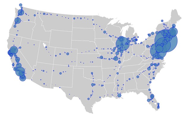
- Two women robbed on Ponce Place [Patch]
- Ponce losing lanes between Boulvevard/Monroe &Freedom Parkway to accommodate bike lanes [Patch]
- The Old Decatur Theater circa 1942 [GSU]
- Tucker artist paints Walmart interiors [Atlanta Art Blog]
- It’s going to pour this afternoon [AJC]
- Atlanta Streets Alive gets $50,000 from city [Fresh Loaf]
- Amtrak only serves certain parts of U.S. [Atlantic Cities]
Amtrak map courtesy of Mulad via Flickr


Where was the Decatur theater? (Pictured with “Hellzapoppin,” starring Shemp Howard of Three Stooges fame, on the marquee.) Boy, it would be great to have a theater like that in town.
http://the-decatur-theatre.blogspot.com/
Believe it was where the parking lot is between Best Time and Eddies.
I have no clue how feasible it would be, but bike lanes on Ponce from Decatur to Midtown would be outstanding.
One lane in each direction between Scott and Moreland is barely wider than a bike lane now.
The Patch today also reported several auto break-ins on West Ponce in the last two weeks. Do we have a worsening crime problem downtown?
The car break ins are going on all the time in my neighborhood. Armed robbery on the street is a horse of a different color. Anybody have the stats for number of armed robberies per year in the city? I would think it is a pretty rare occurence.
You could pull it up with crimereports.com.
I am curious in particular about the auto break-ins on West Ponce; there were 4 reported in 6 days. Were these on the street or in parking lots?
I believe a couple were at the post office. I remember at least one being called in from there.
In our lifetime, will we see a reasonable passenger rail map of the US? It’s nuts that you can’t take a train from here to Chicago.
“It’s nuts that you can’t take a train from here to Chicago.” Or Savannah.
You need to strongly express to the people in DC that there are better, more efficient means of transport than cars and planes. It won’t happen on its own.
I’m not sure I would use the efficiency of Amtrak as an argument for more Amtrak, if that’s your point. 41 of their 44 routes lose money. All long distance routes lose money. Maybe, and it’s a big maybe, a private railroad could do better but not as long as it has to complete with the government subsidized, unionized, National Railroad Passenger Corporation.
Also, the flight from here to Chicago is, what, an hour and a half, tops (assuming no delays)? How long would Amtrak take? My guess would be in the 6 hour range, at least.
Exactly. I wanted to point out that we also don’t have Pony Express to Chicago either, but you made the same point more politely.
It’s not a bullet train, so probably closer to 12 hours. But IMO the meaningful way to gauge time required for air travel is not the length of the flight but time spent curb-to-curb (from the time I leave ground transport at my departure location to when I embark on ground transport at my destination). Atl-Chi is a lot more than 90 minutes. I used to travel a lot for biz and grabbed any opp’ty to use trains. It only ever was feasible in the Northeast and between Seattle/Portland, but it was so much less stressful and more productive than flying.
Take a look. Highways “lose money” also. Taxes and fees only cover about 2/3 of the cost to build and maintain them.
Decatur PD has a wireless surveillance camera system that they got for free. It has cameras at the Square, MARTA, plus another 60 or so at DHS. It is possible to expand this. If they were up and down Ponce, Trinity and some other streets it would be a great start.
Big Brother finds this message double plus good…
Ah, perfect for targeting unruly civilians for drone strikes.
Nothing says freedom like constant government monitoring.
Re: Bike lanes on Ponce (first I’ve heard of it!). I just left the following comment over on the Patch site as well:
Great news – sort of. Seems like an awfully short stretch. What is a westbound cyclist on Ponce expected to do when they reach the intersection with Boulevard/Monroe? Neither Boulevard nor Monroe is particularly bike friendly, so it seems like a cyclist would be stuck with no option: Can’t (safely) keep going west, can’t (safely) turn left, can’t (safely) turn right.
In the other direction, why not take this further to at least connect with the existing PATH just east of Freedom Parkway? It’s only an additional 2 blocks (500-700 ft according to Google Maps)!
I guess we need to start somewhere, but poorly thought out and disconnected bike lanes really don’t help people to get around this city without a car. And if the bike lanes aren’t heavily used (because they’re not useful), people will inevitably claim that they are a waste of money and road space.
This bike lane proposal is just plain crazy. It seems like the only traffic plans around these days is to make travel more difficult. I sure glad I don’t have to commute on that stretch of Ponce.
Haven’t you noticed that bikes are rolling traffic calming devices?
For those of us trying to get where we’re going without a car, travel really can’t get more difficult (or unsafe) than it currently is. A little bit of equity is welcomed.
Now that you mention it, I have noticed an aura of calmness surrounding bikes and cars when they mingle. No, wait, that was bikes and pedestrians. No, maybe it was bikes and bike trails, that was probably it. I do think we have a likely unsolvable problem: bicycles and cars can never co-exist safely on the same turf without a lot more space than metro Atlanta has. I was in Vienna this summer, great bike lanes that we have no possibility of duplicating. Wash, DC has terrific bike trails that we have no possibility of duplicating. PATH has some fun ones in place that don’t compete with traffic here, but we simple don’t have the room to make bike lanes a real alternative to commuting.