CSD Adds an Eighth K-3 Redistricting Map
Decatur Metro | October 29, 2010 | 5:44 pmAssistant Superintendent Thomas Van Soelen writes in…
In addition to the free/reduced lunch data that has been added this week, a new was added: map 8. all maps are still available at this site: http://fiscalresearch.gsu.edu/decatur/
Upon analysis of the narrative comments offered by community members, Maps 4 and 7 emerged as most appealing. Map 4 offers the best racial and socioeconomic mix, labeled “differential” on the pros/cons list. Map 7 allowed one of the smallest school sites, Clairemont, to remove the learning cottage.
A concern about Map 7 arose regarding the number of Black students that would be attending Oakhurst. The perception may be a reversal of Board policy regarding the integration of students, capped by the removal of the Desegregation Order in 2007.
Map 8 has been created so that the racial and socioeconomic differential of Map 4 is achieved but with no learning cottages needed at any of the sites. In addition, Map 8 divides Decatur Housing Authority into three areas, thus creating more of a consistency between schools. This division of three has historical precedence: during the years of 7 elementary schools, Allen Wilson Terrace was divided north/south. The proposed line would divide that area east/west.
The community can learn more about the process on Wednesday, November 3 at 6 pm, Westchester, and/or talk to the Board of Education at 7 pm.


And of course, McCoy is still divided in half and a chunk of Oakhurst is sent to Winona. I wonder who the community members are who like 7? The only person I have heard who likes 7 is Phyllis Edwards. The overall response at our school was negative on 7.
Hmm. This map only reduces Clairemont by 3 students so I don’t think it solves the problem of being too close to capacity there. And it still leaves Winnona Park with many fewer students than it can hold and an awfully low proportion of low income students.
Modifying this map, isn’t there a way to keep Swanton Hill with Winnona Park, reduce the amount of “Oakhurst” students that go to Winnona Park as nelliebelle wants,and then maybe give a slice of the Clairemont zone to Glennwood so Clairemont isn’t too big and Glennwood isn’t too small? I know that splitting off part of the traditional Clairemont district might get some objections but the tradeoff would be that they would be in a fairly spiffy elementary school that wasn’t too crowded and had lots of opportunity to develop its own character, strengths, and community as a new school.
Or Mr. Fix-it’s modification of Map 4 sounds good too.
I just think it’s silly in such a small town to split streets!
karass,
as i shared with the board at the october worksession, it is not about total number of students that makes a building full of classrooms; rather, it is what grade levels the students are in. changing the lines in map 8 for clairemont only reduced from 321 to 318, but it changed the number of classrooms so those students actually fit without the trailer, which was what dr edwards hoped for – removing all trailers from K-5 schools. map 8 does that.
the 210 students that would be zoned for glennwood actually takes 12 classrooms, which is exactly how many classrooms glennwood has. again – not about the number of students, but what grade levels the students are in.
as for dividing mckoy – leave a comment at the site. that certainly can be considered by the board before the final vote that will happen at the december board meeting.
best,
thomas
I’ll always leave a comment.
That’s helpful info that the classroom distributions are another dynamic that have to be considered for each Option. That’s something not obvious on each of the maps and is one of the many reasons that affected families should carefully read all the information available on the website and attend all relevant Board sessions.
It seems a little worrisome to have to make decisions based on enrollment predictions in which just 3 children result in a different grade distribution that determines whether a trailer is necessary or not. That seems a little tight. All one needs is for a few families with twins or one family with triplets to transfer into CSD unexpectedly and mess up the assumptions!
Ha! I have used the triplet scenario myself several times in thinking about this scenario. However, those three students that would not attend Clairemont in the map 8 scenario all caused extra classes to be formed.
In map 4, 16 classrooms (net=-1) would be required at Clairemont; in map 8, 13 classrooms (net=+2) would be required. Those two classrooms could then be used as art, music, Spanish, professional learning….).
But how can you draw lines based on what grades the current students are in? What if over the summer they all move out and an entirely new population moves in? Or all the kids on one street who are in private school now decide to enter CSD? This line of reasoning seems a little off, or am I just misunderstanding what you’re saying? Having the lines comes down to three students seems absurd. We ought to have more wiggle room than that. The population for each school is going to change every year in lots of different ways.
Observations:
Glennwood will serve 210 kids next year. As our 4/5 Academy It serves +/- 400 this year.
Clairemont and Oakhurst still have the largest student populations, with absolutely no guarantee that Westchester will open any time soon .
Most of church street and the northeast part of Decatur, who by the way can’t see Clairemont at all as per the con of Map 3, are going to Clairemont while Glennwood is underutilized.
Winnona, by far the largest school site in our system, will have +/- 100 fewer kids next year.
I can’t really tell which street it is, but it seems like a portion of the current Oakhurst near Avery is being grabbed up and sent to Clairemont while the rest of their neighbors will still go to Oakhurst. Is Rosewalk being divided?
But we feel better about the diversity numbers in this map. Let’s be careful to not treat our children like percentages. What matters is community and continuity.
1. Rosewalk is being divided on map 8 along with all the townhouses on Adair street being sent to separate schools.
2. Many people have complained about the Winnona Park boundaries infringing on the Oakhurst neighborhood but I have not seen any logical suggestions for how to change the boundaries or increase the number of students at Winnona Park. Moving the boundaries North of the RR just due not make sense if you want to keep students walking to school.
3. If the number of classrooms is really such a factor that 3 students can change the makeup of a school by 3 classrooms I think that more needs to be communicated to the community about how classroom sizes affect each map. Based on the assumptions in the Superintendent’s letter to the Board of Education the class size ratio is set to 22 students per classroom. According to this both map 4 & 8 would result in 16 classrooms at both Clairmont and Oakhurst. Is there a different ratio being used as a maximum size allowed? It looks like the maximum class size allowed is 28 students/room if less classrooms are being produced.
RE increasing number of students at Winnona Park and bringing up its low income proportion closer to that of other schools: Isn’t the logical way to do that to keep Swanton Hill at Winnona Park? I’m not sure why none of the eight options have this. Depending on numbers, perhaps that would allow a bit of Oakhurst neighborhood being zoned to Winnona Park to move over to Oakhurst Elementary. Is the problem that it then makes Glennwood too small and some of Clairemont that counted on staying at Clairemont would have to move over to Glennwood? I know the traditional Glennwood neighborhood is generally thrilled at having a K-3 again but asking traditional Clairemont folks to go to Glennwood, not Clairemont, might not go over well. As Nola says, it seems premature to use the annexation issue as a reason for keeping Winnona Park small. It’s not certain and is at least several years into the future. Plus I still don’t see why annexation would have to impact only Winnona Park. Thinking about where Avondale and other proposed annexible areas are, I would think that Glennwood would be an equally logical place, if it had room.
Well, the rest of us have to do it, so why shouldn’t “traditional” Clairemont homes be zoned elsewhere if it make diversity easier and makes mapping sense? I rather resent it that keeping “traditional Clairemont” together should take precedent over keeping other neighborhoods together. Sorry, karass, but I put that argument where you put the three kids make a difference in zoning argument. If Glennwood is underutilized, then that’s the logical division.
Nellie,
I think it’s okay for me to say that neither Karass or I speak for “the traditional Clairemont Community”. And you are absolutely right. All neighborhoods should be in the mix equally. Please remember though, the term traditional “?” is a short term definition. Half of traditional Oakhurst was traditonal Westchester a mere 6 years ago, etc. We were juggled then and ( the parents barely ) survived and we will survive ( and the children will probably thrive after) this transition regardless of where kids end up as well.
Unfortunately, the mapping is complicated now a fourth elementary is needed. Clairemont and Glennwood are close together. It would be much easier to draw balanced districts if we had an elementary school in the northeast quadrant of Decatur, but that ship has sailed. For that reason, you are likely correct. Traditional Clairemont attendence zones probably will need to be changed. Just as most others will as well.
Northwest. I meant to say an elementary in the northwest quadrant of the city.
I am probably sounding more strident than I should, but if don’t think “traditional” boundaries should be a consideration in this if we are aiming for diversity and walkability and a flexibility.
I don’t disagree. I’m just taking into consideration some of the concerns I’ve heard on this blog, e.g. that Oakhurst wants to go to Oakhurst, not Winnona Park. I want all issues to be out on the table, in the open, transparent, so no rumors about hush-hush, murmur-murmur, secret emails, unannounced meetings, secret agendas like what came out last time. The issues that keep coming up that I have recognized on this blog are:
1. Walkability, respect for natural neighborhood lines
2. Diversity across all schools, in terms of income and race/ethnicity
3. Decent classroom sizes at all schools
4. Overall crowding at schools
5. Trailers for students
6. Impact of annexation if it should occur
7. Impact of continued student population growth, if it should occur
What else?
Where is this Swanton Hill you are referring to? The Swanton Hill Townhomes I know about are not in any way a logical neighborhood to send towards Winnona Park, nor do they have a large population of young students.
I also meant to ask if there is a map of the current district lines? I have found a pdf document listing streets and house parcels in the past but no maps of the current distribution.
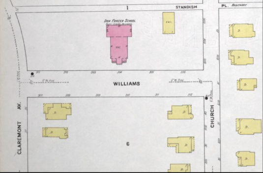
the last document on this webpage offers a current enrollment zone map.
http://www.csdecatur.net/schoolzones/02B825E7-000F51A4?object=K-3%20enrollment%20zones%20options&infobar=no&templates=RWD&ConfPosition=2
Can you please put the current attendance zone map in a JPEG format, like options 1-8. I cannot open the document file.
I too have not been able to open this file.
I ended up saving the file to my desktop and adding .jpg to the end of the name. This allowed me to open it with any picture viewer as I think it is just misnamed but it is a jpeg.
Traditionally, Decatur Housing Authority homes have had 3 areas divided up among the northside elementary schools, and then Winnona Park added in the last reconfiguration–Gateway, next to the MARTA tracks and Post Office on the north side of Trinity, Allen Wilson Terrace on the south side of and alongTrinity, and Swanton Hill, on that same side of Trinity but up the hill a bit. Whether these are official or artificial school categories, I don’t know. I know that Gateway has a bit of an autonomous community feel because of the way it is laid out and the common areas for kids to play in.
I would like for CSD to post a map which shows the current districts in the same link as Maps 1-8. We also need to see the CSD pro con list for map 8. The pro con shows the trailer intent.
Most important of all, I think it would be helpful to see where the housing authority children are currently districted. This community is in the throws of change. Many of their friends have been relocated to make way for the new construction at Allen Wilson. Shouldn’t lessening the change in their school experience be an important consideration in the new maps if at all possible. These are children who appreciate continuity in their lives. They are not percentages to be divided amongst three, four, five, parcels……
As CSD Mom so clearly illustrated, it seems these maps are too focused on the procreation rate per street of the last decade. Logical lines should be drawn and as in the past when there is overcrowding a school some children will be sent to another neighboring school. It’s not perfect, at all, but this is the price you pay when you maintain several very small schools.
And when and IF annexation happens, we’ll get to do this again. Such is life.
Karass,
IMHOThe number one question for CSD should be:
What are your intentions for pre-k? This question affects the viability of every map presented.
Before I tear my hair out, can we get consensus on when the first listening session is – NOV 2ND or NOV 3RD??? The CSD website says Nov 3rd (which is Wednesday) but now this post says Tuesday, Nov 2nd. I believe I saw another poster ask this question here too.
from our school:
On November 3, 2010 at 6:00 pm the City Schools of Decatur will hold an Information Session regarding elementary attendance zones in the Edith Hambie Professional Learning Center at Central Office at Westchester (758 Scott Boulevard, Decatur, GA 30030). This session will be followed by a Board of Education Public Hearing at 7:00 pm in the Board Room at the Central Office.
For interested parties who are unable to attend the meetings on November 3rd, a second Information Session and Public Hearing will be held at the Central Office on November 16th at 6:00 pm followed by a Public Hearing at 7:00 pm.
A vote on elementary attendance zones is planned for the December 14, 2010 Board of Education Meeting.
Sorry, Roo. I wrote the incorrect date in the email I sent to Decaturmetro. Thanks for clarifying, anniefannie. Wednesday, it is.
Thanks for the clarification. Did the time change from 6:30p to 6:00p as well? Could have sworn it was the former, which is far more practical for this working mom to make the meeting. At 6p, where the heck do you park if the tiny lot is full?
karass says park on the grass.
Only if you watch Hee-Haw reruns!
It’s easy. Just park on Westchester Ave and walk down the sidewalk on Scott–the school is the first building on your right. There’s even better parking where you can walk on cute paths to the back of the schoolyard but I can’t describe them easily. I never notice the street or dead end names.
From Scott Blvd onto Westchester, the first all way stop is harold byrd drive Left on harold byrd dead ends to the Hidden Cove park/trail. Walking from the trail – Go left on trail and this will take you to the back of the school opps! the back of Center Office. Also, may I also suggest offering a ride to someone else that is interested in attending & carpool, walk if you are in walking distance, ride your bike? Thanks for not parking on the grass!
The other side of the Harold Byrd dead end can be reached from Ridley.
During Westchester’s elementary school days the back door entrance worked great. For evening events folks often brought a flashlight since the park is pretty dark at night.
Hopefully the meeting crowd is going to be large. Maybe the kind families of Westchester Neighborhood will provide some courtesy flashlights on Wednesday night.
And the back door will be unlocked like days of old.
I thought the rationale for keeping Winnona smaller was in anticipation of a bulge of students in the coming few years and not have to redistrict again. And Oakhurst was that way so that when Westchester is reopened, the redistricting is kept to a minimum.
That makes sense but wouldn’t that be true for any of the schools. Or is possible annexation supposed to affect Winnona more? I thought it would affect Glennwood the most.
the annexation plans that first were floated by the city last year and seemed to have the most comparative traction affected winnona the most.
So, basically by their own admission, they have pitted Oakhurst vs. Clairemont in this redistricting battle. That’s unfortunate.
sorry – will not admit any such thing! certainly the goal is for children to attend the school that is closest and most convenient to their home.
Agree with all that the information CSD is providing is useful. In addition, the statement that one goal is that children “attend the school that is closest and most convenient to their home” is nice to have out in the open. It applies to Oakhurst folks who want to attend Oakhurst, not Winnona Park, Winnona Park folks who want to attend Winnona Park, not Glennwood, as well as Clairemont area folks. In the past, if folks expressed that goal, they were accused of not wanting their children with other subgroups of children. Having that goal doesn’t take away from other important goals like diversity by income and race/ethnicity, decent class sizes, and avoiding overall crowding of schools.
Hopefully decisions will be equally transparent. It is real important that there not be even the appearance of unannounced meetings, secret emails, private yahoo groups etc. as there was with the last reconfiguration. Whether or not those events really had an effect, they poisoned community relations for a long time.
Kudos to CSD for their transparency and responsiveness in this process–posting the maps and information online and at the schools, soliciting community input, adding the free/subsidized lunch info, and now coming up with this additional map. People can (and should) continue to raise questions and concerns, but I don’t think we can complain about the way the decisions are being made.
And thank you to Thomas for joining in and responding as best you can. I know you have to maintain a little political action (I’d expect it if I was your boss!) but you are at least reading and responding!!
I just ran into one of our city of Decatur commissioners.
Question: Is the city currently planning to proceed with annexation in the Winnona area?
Answer: I know of no plans for annexation for the area at this time.
It seems that CSD may need to clarify the annexation possibilities with the city. Annexation is not a quick process. If we are talking about annexation that may occur five years from now, I don’t understand why we would redistrict today in a manner that would crowd our children into the Oakhurst and Clairemont and leave Winnona, our largest k-3 site under utilized. When and if annexation occurs, it will likely cause changes to our districts regardless how hard CSD tries to get it right in advance.
Hopefully CSD will provide clarification on the annexation questions next week.
I have heard that residential annexation is off the table for now because it doesn’t bring in enough money and will put burdens on services. This should NOT be a CSD consideration.
Aside from all of the number crunching, there needs to be some common sense on a neighborhood-by-neighborhood level in the reconfiguration. As cc points out, Rosewalk is being divided, which makes zero sense if you have ever walked or driven through the neighborhood. I understand that there are always going to be neighbors going to different schools, but the kids from Rosewalk zoned for Clairemont in map 8 will have to drive past the houses zoned for Oakhurst. There are probably a number of other neighborhoods in this map and others where this is an issue, I just happen to notice it for Rosewalk. Hopefully, common sense will play a part in the final adopted plan.
As an Oakhurst resident, I greatly appreciate the addition of Map 8. Map 7 was too racially divisive. However, I continue to have concerns that Oakhurst is overcrowded compared to WP. Also, why does WP keep the track as the boundary when Oakhurst crosses WAY over the track? In addition, Map 8 continues to ignore many of the streets that actually comprise the Oakhurst district (McKoy, W. Benson, W. Hill, etc.). Is there not a way to encompass Oakhurst rather than crossing the tracks so much?
Yes. Open Westchester.
All this reconfig hand-wringing in such a small city. Such a waste.
A sutiable building stands with its back door open, ready to welcome parents — and children, like it did for over 50 years. And yet it is not on any Map reconfiguration. When will common sense prevail?